Milton-Freewater, OR Profile
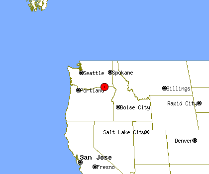
Milton-Freewater, OR, population 6,319, is located
in Oregon's Umatilla county,
about 127.8 miles from Spokane and 192.9 miles from Boise.
Through the 90's Milton-Freewater's population has grown by about 17%.
It is estimated that in the first 5 years of the past decade the population of Milton-Freewater has stayed about the same. Since 2005 Milton-Freewater's population has declined by about 1%.
Milton-Freewater's property crime levels tend to be about the same as
Oregon's average level.
The same data shows violent crime levels in Milton-Freewater tend to be lower than Oregon's average level.
Population Statistics
Gender
| Population by Gender |
|---|
| Males | 48% |
| Females | 52% |
Race
| Population by Race |
|---|
| White | 74% |
| African American | 0% |
| Native American | 1% |
| Asian | 0% |
| Hawaiian | 1% |
| Other/Mixed | 24% |
Age
| Median Age |
|---|
| Population | 9.99 |
| Males | 9.99 |
| Females | 9.99 |
| Males by Age | Females by Age |
|---|
| Under 20 | 9.99% | | Under 20: | 9.99% |
| 20 to 40 | 9.99% | | 20 to 40: | 9.99% |
| 40 to 60 | 9.99% | | 40 to 60: | 9.99% |
| Over 60 | 7.00% | | Over 60: | 9.99% |
Size
| Population by Year | Change Rate |
|---|
| 2000 | 6,470 | N/A |
| 2001 | 6,475 | 0.08% |
| 2002 | 6,456 | -0.29% |
| 2003 | 6,428 | -0.43% |
| 2004 | 6,406 | -0.34% |
| 2005 | 6,394 | -0.19% |
| 2006 | 6,359 | -0.55% |
| 2007 | 6,299 | -0.94% |
| 2008 | 6,283 | -0.25% |
| 2009 | 6,319 | 0.57% |
Economics
| Household Income |
|---|
| Median | $28,365 |
Law Enforcement Statistics
Violent Crime Reports
| Rate Per 100K People |
|---|
| 2001 | 122 |
| 2002 | N/A |
| 2003 | N/A |
| 2004 | 245 |
| 2005 | 199 |
| 2006 | 137 |
| 2007 | 188 |
| 2008 | 174 |
| 2009 | 218 |
| 2010 | N/A |
| Vs. State Violent Crime Rate |
|---|
| Year |
Murder, Man-Slaughter |
Forcible Rape |
Robbery |
Aggravated Assault |
| 2001 |
1 | 1 | 3 | 3 |
| 2002 |
- | - | - | - |
| 2003 |
- | - | - | - |
| 2004 |
0 | 5 | 2 | 9 |
| 2005 |
0 | 3 | 2 | 8 |
| 2006 |
0 | 1 | 1 | 7 |
| 2007 |
0 | 0 | 0 | 12 |
| 2008 |
0 | 0 | 1 | 10 |
| 2009 |
1 | 1 | 1 | 11 |
| 2010 |
- | - | - | - |
Property Crime Reports
| Rate Per 100K People |
|---|
| 2001 | 3,731 |
| 2002 | N/A |
| 2003 | N/A |
| 2004 | 5,475 |
| 2005 | 4,675 |
| 2006 | 4,992 |
| 2007 | 3,270 |
| 2008 | 2,833 |
| 2009 | 2,868 |
| 2010 | N/A |
| Vs. State Property Crime Rate |
|---|
| Year |
Burglary |
Larceny, Theft |
Motor Vehicle Theft |
| 2001 |
61 |
174 |
10 |
| 2002 |
- |
- |
- |
| 2003 |
- |
- |
- |
| 2004 |
85 |
248 |
24 |
| 2005 |
69 |
223 |
14 |
| 2006 |
80 |
229 |
18 |
| 2007 |
49 |
151 |
9 |
| 2008 |
48 |
119 |
12 |
| 2009 |
51 |
120 |
13 |
| 2010 |
- |
- |
- |
Location
| Elevation | 1,033 feet above sea level |
| Land Area | 1.7 Square Miles |